Chimimbe Hill Ni-Co-Cr
Introduction
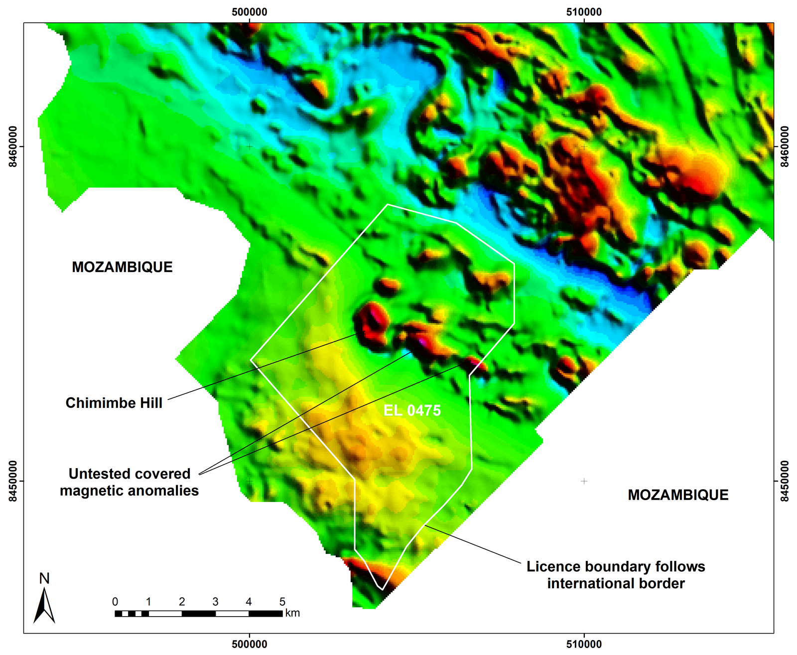
Mkango subsidiary Lancaster Exploration Ltd was awarded the 98.48km2 exclusive prospecting licence EPL 0475/17 Chimimbe Hill in Mchinji district on 10th November 2017 to explore for nickel, cobalt, gold and other associated minerals. The licence was renewed as exploration licence EL 0475/17R in November 2020 with a reduced area of 47.96km2.
Location
Chimimbe Hill is located west of the administrative capital Lilongwe, 82km along the M12 paved road toward Mchinji and 14km on a good all-weather gravel road toward Zambia. The prospect lies 12km from the railway line connecting to the deep-sea port of Nacala on the Mozambique coast approximately 600km to the east. The national power grid is 6km from Chimimbe and there is abundant water nearby.
Geology and Geophysics
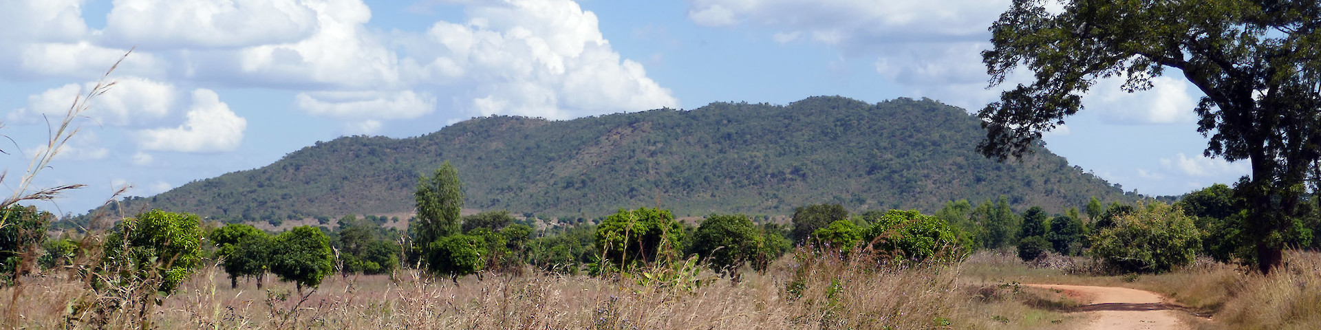
Chimimbe Hill is a prominent, north-south trending ridge about 1,200m long and 500m wide with a very steep western flank and variable eastern flank comprising flatter areas interspersed with steeper sections. It rises 140m above the level of the surrounding plain to 1,261m above sea level.
Chimimbe Hill is underlain by a deformed serpentinised ultramafic body with a minor mafic component. The country rocks are mostly unexposed but are presumed to consist of highly metamorphosed rocks of the Mozambique Mobile Belts. Locally there are minor outcrops of quartzite; otherwise the surrounding lithological variation is only reflected by changing soil colour and texture. The ultramafic body is presumed to be confined to the hill itself with two much smaller bodies nearby.
The Chimimbe Hill serpentinite contains elevated nickel, chromium and cobalt values. The nickel-cobalt mineralisation is mainly associated with silicates within the weathered serpentinites whereas the chromium is associated with chromite in conjunction with magnetite.
The soil cover is of variable thickness. The saprolite is essentially a leached clay-rich zone that historical drilling has shown to be up to 30m thick. The hill is surrounded by red-brown soils formed by downwash from the hill. These are commonly greater than 2m thick and show a variable degree of lateritisation ranging from dispersed nodules to local development of sheet laterite.
A magnetic anomaly map from the 2016 World Bank funded countrywide airborne survey reveals a large magnetic anomaly associated with Chimimbe Hill, extending below surface to the east of the hill and beyond the historical exploration area.
Historical Exploration
The Chimimbe nickel anomaly was identified by the Geological Survey of Malawi from soil sampling and limited pitting in 1968–1970, when Ni values of 6,000–8,000ppm were obtained from samples collected from the bottom of pits.
Work by Lisungwe Mineral Resources Plc in 2007–2009 involved the excavation and sampling of 904 pits and an open-hole percussion drilling programme of 73 holes amounting to 1,538m over an area of approximately 587,300m2. Samples were assayed using a Niton handheld XRF analyser, and a selection of those samples were also assayed at OMAC Laboratories in Ireland. An analytical QAQC programme of blanks, duplicates and in-house standards was employed. Samples from the open-hole percussion drilling yielded weighted average grades of 0.37% Ni, 0.59% Cr, and 0.03% Co over intervals ranging from 1m to 31m. A qualified person has not done sufficient work to verify the accuracy or precision of these grades or the methodology of the sampling and analysis, and they are not being treated by the issuer as current overall grades for the deposit.
A ground magnetometer survey was completed over the area, identifying four zones with a similar magnetic signature to that associated with the Chimimbe Hill mineralisation. Geochemical soil sampling traverses were completed across the magnetic anomalies to test the nickel response. Blanket soil geochemistry at a 400-m traverse interval was completed over the entire licence area.